MISSION TRAILS 5 PEAK CHALLENGE IN ONE DAY
Last October while researching San Diego area hikes, I came across something interesting, the Mission Trails Regional Park Five Peak Challenge. The challenge was designed to encourage exploration of the large park beyond the easily accessible, San Diego classic Cowles Mountain peak.
After reading the website and reviewing a few Instagram posts, I realized the challenge could be completed in a day. I decided pretty much instantly that I wanted to do it…and wanted to do it in one day. With some training, it seemed doable. The idea then got pushed to the back of my mind as I switched my focus back to my overlapping goals of a hike a week for the last quarter of the year (completed!) and training for a trail half-marathon (in progress!).
Fast forward to last week.
After attending an REI Three Season Survival class at Mission Trails last Sunday, I ran into one of the guys from the class after it had ended. He invited me to join him on a hike. My legs were tired from a run the day before. I had work to finish. But I had also wanted to go for a little hike. And when someone serendipitously invites you to do exactly what you want to do, you say yes!
On the hike, I mentioned the Mission Trails Five Peak Challenge. He was instantly enthusiastic and optimistic about the prospect of finishing if we did it together…in January, the same month. His enthusiasm for his own capabilities seemed to have more of a factual basis than his trust in my abilities. But the enthusiasm none-the-less wore off and I found myself looking back at the challenge website the next day, feeling excited about the prospect of going for it.
I texted my new friend and we hatched a plan to go for it four days later, on Friday. And by plan, I mean we decided on a time to meet. So, yesterday, less than a week after meeting, we conquered the five peaks together in one day! It was a challenge but also a lot of fun. Truly, would not have wanted to spend my Friday anywhere else.
With that background, here’s the post-hike report:
PARKING
The route we did is not a loop. To avoid making it a longer day than necessary, we staggered our cars so we could drive rather than walk, run, hitchhike, or Uber back to the start after completing the challenge.
Car 1: Outside park gates near Kumeyaay Lake Campground (8915 Bushy Hill Drive, Santee, CA 92071)
Car 2: Parallel parking on Navajo Road by Cowles Mountain trailhead (7001 Golfcrest Drive, San Diego, CA 92119)
Ironically, even though we had split our cars to avoid hiking further than needed, I think that if it were not for weaning daylight at the end of the hike, we would have convinced ourselves that we should just keep going to hit 20 miles.
ROUTE
You can complete the peaks in any order, you just have to stay on the park’s designated trails, i.e. no bush-whacking. Like many seem to, we started with Cowles to knock out the highest peak while we were fresh. It is also the most crowded trial so it’s good to knock it out before it gets more crowded.
Our Route:
- Cowles Mountain Trailhead to Cowles Mountain Peak
- Cowles Mountain Peak to Pyles Peak
- Back to Cowles Mountain Trailhead
- Cowles Mountain Trailhead to Kwaay Paay Trailhead via Golfcrest Drive / Mission Gorge Rd / Father Junipero Serra Trail (road walking)
- Kwaay Paay Trailhead to Kwaay Paay Peak
- Back to Father Junipero Serra Trail and across to Oak Canyon Trail
- Oak Canyon Trail to Fortuna Saddle Trail
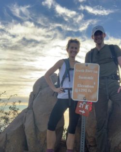
- Fortuna Saddle Trail to North Fortuna Trail to North Fortuna Peak
- North Fortuna Trail to South Fortuna Trail to South Fortuna Peak
- Back down to car near campgrounds
- Cowles Mountain Trailhead to Cowles Mountain Peak
- Cowles Mountain Peak to Pyles Peak
- Back to Cowles Mountain Trailhead
- Cowles Mountain Trailhead to Kwaay Paay Trailhead via Golfcrest Drive / Mission Gorge Rd / Father Junipero Serra Trail (road walking)
- Kwaay Paay Trailhead to Kwaay Paay Peak
- Back to Father Junipero Serra Trail and across to Oak Canyon Trail
- Oak Canyon Trail to Fortuna Saddle Trail
- Fortuna Saddle Trail to North Fortuna Trail to North Fortuna Peak
- North Fortuna Trail to South Fortuna Trail to South Fortuna Peak
- Back down to car near campgrounds
TIME AND DISTANCE
My Garmin died at 11.9 miles, I don’t know exactly what total distance and elevation gain was. However, the following are pretty good estimates based on prior tracking of the section where my Strava died, maps, others’ Strava routes, and iPhone estimates. Time is more precise because my friend had a stopwatch.
Time:
5 hours 55 minutes 30 seconds from base of Cowles to 5th Peak (Yay! Under 6hours!)
Apx 7 hours total (after the fifth peak, we didn’t care to pay too much attention to time)
Distance:
Base of Cowles to 5th Peak: Apx 15 miles
Total Hike: Apx 17+ miles
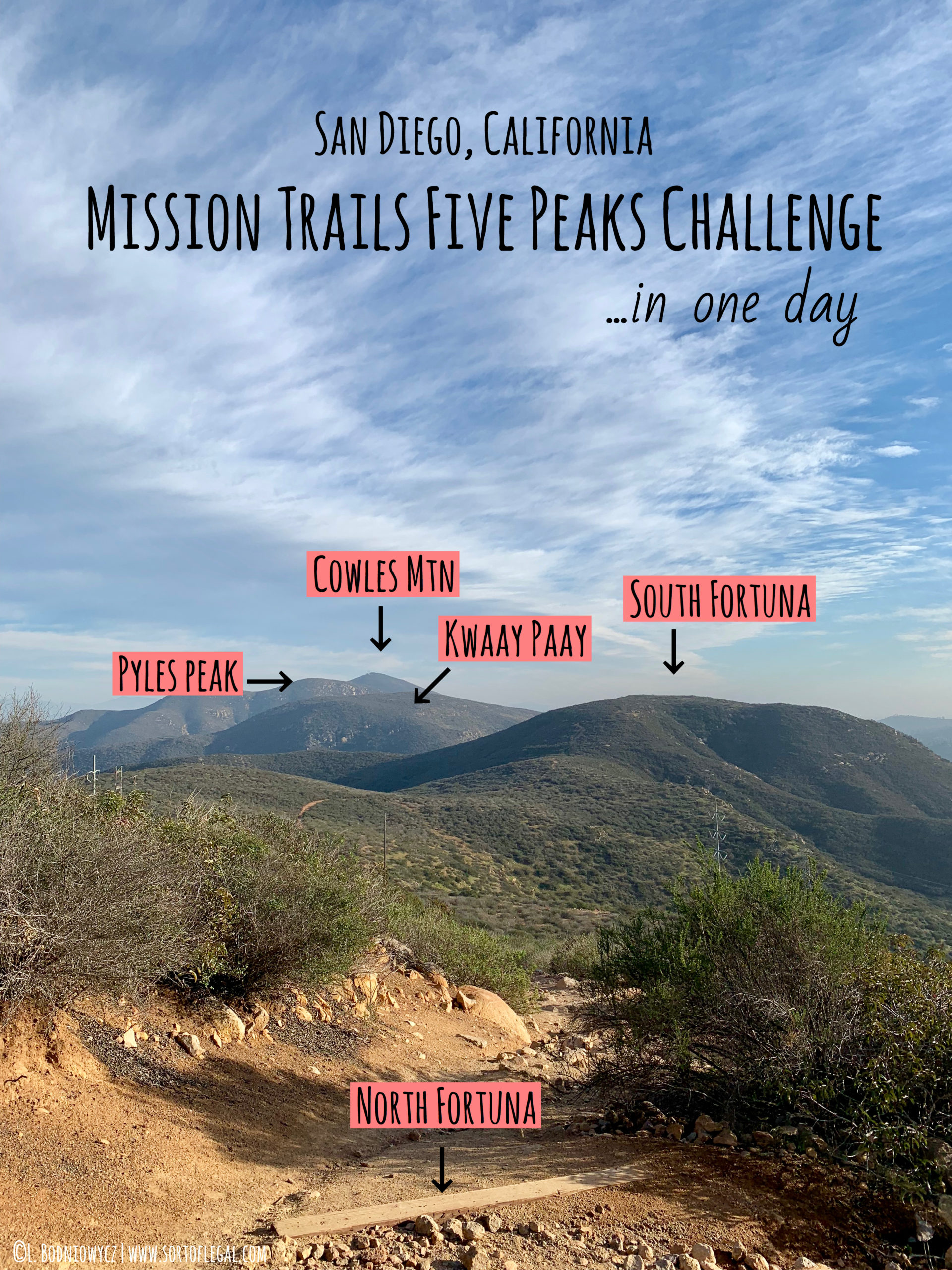
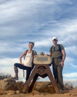
THE FIVE PEAKS
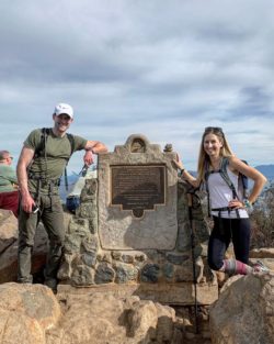
Peak 1: Cowles Mountain (Elevation: 1,592)
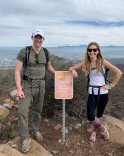
Peak 2: Pyles Peak (Elevation: 1,379)
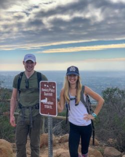
Peak 3: Kwaay Peak (Elevation: 1,194)
Peak 4: North Fortuna (Elevation: 1,291)
Peak 5: South Fortuna (Elevation: 1,094)
FOOD, WATER, GEAR
Water: 3L water each in bladders in packs. We also each added a packet of Trioral rehydration salts to our water at different points. I had about 1L water remaining. If it was summer, I probably would have finished the 3L.
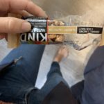
Food: I had a Kind bar (and a half), most of a ziploc baggie of self-made trail mix, and maybe a 1/4 of an almond butter and nutella sandwich (hard for me to down stuff like that while in the process of working out). He finished the sandwich off for me but didn’t eat anything else. Had other snacks that didn’t end up needing.
Attire: What you see in the photos is what we wore 90% of the day and it was comfortable, but a little on the warm side. Shorts probably would have worked for most the day. I put on a light long sleeve and he threw on a light wind-proof jacket for the way down from South Fortuna. AM was in the 50s but got up to the 60s.
Shoes: Both went with hiking shoes instead of trail runners. The extra stability and tread that you get with trail shoes over running shoes was worth the (slight) extra weight, especially since we were hiking not running. Definitely some uneven, slippery sections.
Packs: Other than food, this is one area we differed on approach. I went with my go to Camelbak (one of the three bags I use for 95% of my travel) which is spacious and packed it with first aid kit, my camera (didn’t end up using), snacks galore, wallet, and an extra layer. He went with a nice, light Osprey pack that fit the 3L bladder, light (and small) jacket, and a small Swiss army knife.

